|
SEIDFJELLET FORMATION (T-37) 
DISTRIBUTION shown in fig. 4-07 STATUS OF UNIT: Formal FIRST USE OF NAME: Here CURRENT DEFINITION: Prestvik 1978 SYNONYM(S) AND REFERENCE(S): None ORIGIN OF NAME: Seidfjellet: A mountain with a basalt plateau in eastern Andrée Land adjacent to Tavlefjellet. TYPE SECTION: Stratotype: Seidfjellet (''Tavlefjellet'' according to Murašov & Mokin 1976) STRUCTURAL SETTING: Miocene-Pliocene plateau of northern Svalbard, still recognised by a northward inclined gipfelflur of the mountain tops in Andrée Land DEPOSITIONAL AGE: Miocene-Pliocene DATING METHOD: Isotopic age determination, K-Ar and 40Ar/39Ar methods REFERENCE(S) FOR AGE: Burov & Zagruzina 1976; Prestvik 1978 OVERLYING UNIT(S): None UNDERLYING UNIT(S): Andrée Land Group (Devonian) and Pre-Old Red SUPERIOR UNIT: None OTHER USE OF NAME: None THICKNESS: < ca. 400 m (275 m in type section) MAIN LITHOLOGIES: Basalt LOWER BOUNDARY DEFINITION: The lower boundary is marked by the base of Cenozoic basalt flows or associated pyroclastic rocks above Devonian or older rocks. DESCRIPTION: The Seidfjellet Formation consists of plateau lavas unconformably overlying Devonian (occasionally Precambrian) rocks in the area around Woodfjorden (NW Spitsbergen). They are only preserved within the limits of the Devonian Graben. Their thickness is 275 m in the type section (Burov & Zagruzina 1976), where up to 15 lava flows (Hoel 1914) are reported, with interbeds of scoriaceous material. The lavas are transitional olivine basalts (both ne- and hy-normative types). A prominent pre-basalt palaeorelief is observed in the area around Scott-Keltiefjellet and Løyndfjellet, where the thickness of the lava flows locally reaches up to ca. 400 m above the valley bottoms in the underlying incised relief (fig. 4-50). The lavas are thought to represent different degrees of partial melting of a mantle source where clinopyroxene was a residual phase. Trace element data suggest that some of the basalt magmas were contaminated by crustal material (Prestvik 1978). K/Ar age determinations yielded ages of 60±25 and 22±10 Ma (Burov & Zagruzina 1976), 11.5±1.2 and 10.4±1.1 Ma (Prestvik 1978). 40Ar/39Ar age determinations yielded 8.7 Ma for the Manbreen exposure in Ny Friesland (Prestvik, Ohta pers. comm. 1994). Back to top Sutorfjella conglomerate (T-38) 
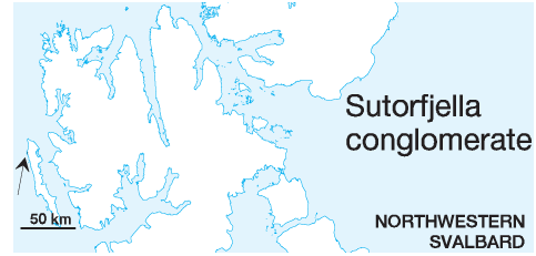
DISTRIBUTION shown in fig. 4-06 STATUS OF UNIT: Informal FIRST USE OF NAME: Hoel 1912 CURRENT DEFINITION: Craig 1916 SYNONYM(S) AND REFERENCE(S): "Sutor" conglomerate: Hoel 1912; Sutorfjella conglomerate member: Harland et al. 1979 ORIGIN OF NAME: Sutorfjella: A mountain area on northwestern Prins Karls Forland TYPE AREA: Sutorfjella STRUCTURAL SETTING: Occurs locally on the Western basement province DEPOSITIONAL AGE: The conglomerate has not been dated conclusively. All published interpretations are based on "resemblance" when compared with Svalbard's deposits of the respective ages. Geologist of the Norwegian Polar Institute presently mapping the area favour Atkinson's Late Proterozoic age interpretation (A. Hjelle, Y. Ohta, pers. comm. 1997). The unit is included here, because the Cenozoic option has been favoured repeatedly, e.g. by Rye Larsen (1982, unpubl.). REFERENCE(S) FOR AGE: Late Proterozoic (Atkinson 1956); Devonian (Craig 1916); Cenozoic (Tyrrell 1924) OVERLYING UNIT(S): None UNDERLYING UNIT(S): Pre-Old Red SUPERIOR UNIT: None OTHER USE OF NAME: None THICKNESS: Several hundred metres MAIN LITHOLOGIES: Conglomerate LOWER BOUNDARY DEFINITION: Unconformable boundary with underlying metapelitic and metapsammitic rocks of the metamorphic basement. DESCRIPTION: The Sutorfjella conglomerate occurs locally in a fault block of ca. 4 km exposed length on northwestern Prins Karls Forland. It consists of polymict, pebble to boulder size, greenish-grey to yellow-brown conglomerates with a weak slaty cleavage. The total thickness of the unit is not known, but it certainly attains several hundred meters. Back to top |
